AD72
The Romans built Isurium Brigantium (Aldborough) about AD72 where the Brigantes had their capital – on the south side of the Ure near the Milby ford on the road from York to the North. At about the same time a fort was built at Boroughbridge, west of the site where the Devil’s Arrows stand, to protect a crossing of the River Ure. (In fact, evidence of three phases of military occupation were revealed here during the building of the Walshford-Dishforth section of the A1M.)
11th C
The Normans moved the crossing to its present site in the late 11th century and a community began to grow up around it. The first bridge was built of wood and, because of the volume of traffic, has needed constant repair, strengthening, widening and rebuilding ever since. It was not rebuilt in stone until the 16th century. A stone plaque on the bridge states that the downstream side dates from 1562 and the upstream (after further widening) from 1784.
12th C
The town of Boroughbridge was the 44th “new town” to be created by the Normans and it rapidly grew in importance as a river and road centre. In 1115, together with Aldborough, Milby, Roecliffe, Durnsforth and Grafton, it became part of the Honour of Knaresborough (an Honour was a collection of manors controlled by one Lord).
13th C
Two corn mills and a fulling mill were already established in the town by the 13th century. One of the corn mills was on the River Ure, the other on its tributary, the Tutt. In 1299 a writ was issued empowering the burgesses of Boroughbridge and Aldborough to return two members for each town to the Parliament of 1300. (Because of the cost to the individual, there was no further representation for Boroughbridge for more than 250 years.)
14th C
A charter granted by Edward II in 1310 gave Boroughbridge a Saturday market and three fairs — and granted the burgesses freedom from tolls throughout England. In 1318, and again the following year, the town was torched by the invading Scots.
At the Battle of Boroughbridge (1322) Sir Andrew Harclay defeated the rebel Earl of Lancaster who sought refuge in the church (then on St James’s Square) but Harclay’s men broke sanctuary to take Lancaster prisoner. He was sent to York, given a mock trial and beheaded as a traitor.Harclay was made Earl of Carlisle but shortly afterwards he too turned against Edward, was captured and beheaded in 1323. (He is remembered in the Harclay Bar in the town’s Rose Manor Hotel.)
16th C
In 1553 William Tankard (Recorder of York) and Christopher Wray (Lord Chief Justice) were returned as Boroughbridge’s first MPs for 250 years.
In 1569, while Tankard (sometimes Tancred) was wisely visiting York, his Boroughbridge manor house (now the Crown Hotel) was the meeting place for the Council of the North where local notables, led by the Earls of Northumberland and Westmoreland, planned to free Mary Queen of Scots and restore the old religion (presumably disposing of Elizabeth).On William’s death in 1573 (he is buried at Aldborough) his son Thomas turned the manor house into a Mass centre for seminary priests and local families. In 1579, Thomas Mudd (priest) was apprehended there together with Thomas Tankard’s wife, her daughter, and son-in-law Richard Norton. They had been betrayed by William’s eldest son.
18th C
Boroughbridge Races were held for the first time in 1732 and they continued until 1808.The iron bridge over the Tutt in Fishergate was built in 1754 by the remarkable “Blind Jack” of Knaresborough (Jack Metcalfe 1717-1810). Despite being blinded at the age of six – Metcalfe rode, swam, made many solo long-distance walks (including London to Harrogate faster than a patron’s carriage) and enjoyed a late and highly successful career as a bridge and road builder of renown. The Ure was made navigable to Ripon (Act of Parliament 1767) by means of cuts and dams and six locks. The weir at Boroughbridge is thought to have been built between 1767 and 1769 and the canal, by the roundabout, in 1770.
19th C
The national school was built on St James’s Square in 1832 and is now the town library with meeting hall above. A railway station was built (on the Milby road) in 1848. The line went to Pilmoor (on the main N-S line) and was extended to Knaresborough in 1875 and a new station built on the Kirby Hill road.
The medieval church on St. James Square was demolished in 1851 and the present church built in Church Lane (previously Back Lane) the following year incorporating some items from the original. In 1852 the Battle Cross commemorating the Battle of Boroughbridge was removed to Aldborough. Gas street lighting was introduced to the town in 1860 and to Aldborough in 1862 (electricity was not in general use in the town until 1936). The fountain in St. James Square was built over an artesian well in 1875 and became the principal source of water for the town.
20th C
The town was by-passed in 1963 and lost the Great North Road traffic for the first time in 800 years.
An overview
In the busy season two thousand cattle a day were driven across the bridge on their way from Scotland to markets in the south. In its heyday the town boasted 22 inns which served not only the drovers but travellers by road and river; the crews of the river boats with their cargoes of lead, linen, wines, spices, etcetera; the horse traders who came to do business on Horsefair; the gipsies who flocked to the Barnaby Fair and, of course, the tradesmen and workers who provided the services and goods all these people required. Various trades came and went: smiths, farriers, candlemakers, thread and ropemakers, millers, boatbuilders, saddlers, fishermen, farmers and much more. A guillotine to cut iron can be seen in Horsefair where the blacksmith’s forge was situated. There is also a wheelplate in the pavement.
In essence the town was built on three squares with linking streets. Market (now Hall) Square was built close to the river with St. James’s Square at the opposite end of the High Street and the small square of St. Helena across the River Tutt off Horsefair. The fourth Devil’s Arrow was cut up and incorporated in the Peggy Bridge which links St. Helena to St. James’s Square (note the eel traps on the upstream side). The white cottages on Hall Square were built as fishermen’s cottages (and originally extended further along the banks of the Tutt before the gates of Boroughbridge Hall were built).
With the coming of the stagecoach the town, with its many inns, became one of the busiest staging posts on the Great North Road. The Crown alone had stabling for 100 horses. There were daily coaches from Leeds to Boroughbridge, and Leeds to Newcastle. The North Star (heading for Carlisle and Edinburgh), The Defence (bound for Durham), The Royal Charlotte (Sunderland) and many more, all called at Boroughbridge. Travelling by stagecoach was surprisingly expensive: Leeds to Newcastle for example cost 28 shillings inside, 14 shillings outside.
A century of change
The coming of the railways robbed Boroughbridge (which was not on the main line and was destined to lose even its branch line) of much of its importance in the transport of goods and people. The River Ure Navigation became insolvent and was sold out to the Leeds and Thirsk Railway Co. in 1847.
Stagecoach transport had disappeared by 1853 and the town had lost seven of its 22 inns. Some disappeared completely, others found new roles: The Three Greyhounds (next to the post office on Horsefair) originally the home of the Mauleverer family, has been converted into flats but still sports the three greyhounds of the Mauleverers’ crest. Another inn (by the bridge),previously a warehouse became homes for the elderly. One High Street inn became a newsagent’s and another a greengrocer’s.
In 2005 eight pubs or hotels are still trading in the town: The Rose Manor (previously The Three Arrows and originally Arrowfield, a private house), Farndale House, The Musketeer, The Anchor, The Grantham Arms, The Crown, The Black Bull, and The Malt Shovel. Another four: The Ship (Aldborough), The White Swan (Minskip), The Fox and Hounds (Langthorpe), and The Blue Bell (Kirby Hill), are all within a mile or two of the town centre.
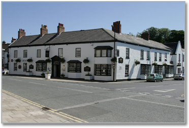
The Crown Hotel
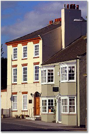
©FreeFoto.com
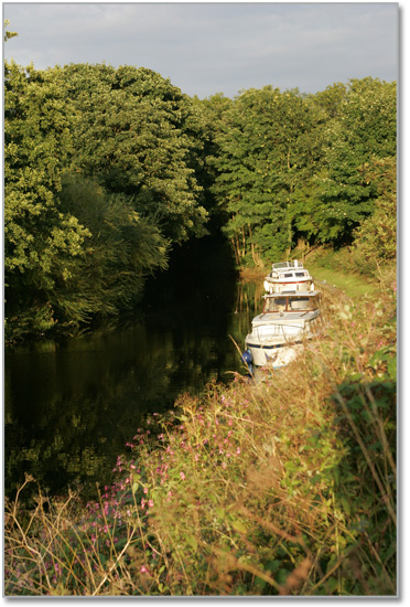
The Canal
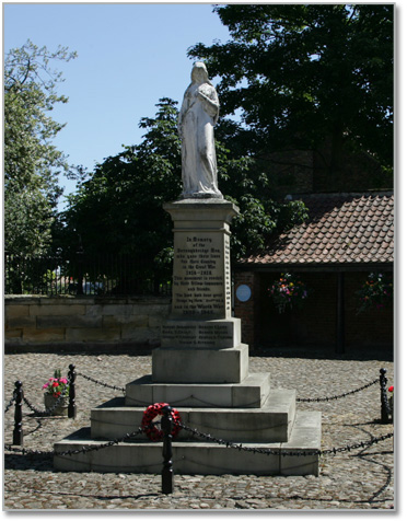
Hall Square
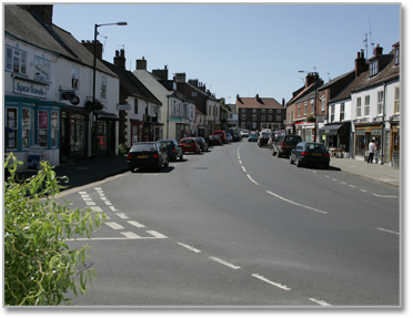
The High Street